PhotoSurveyor is a high-performance utility designed to bridge the gap between field photography and geographic visualization. PhotoSurveyor allows you to visualize your GPS-tagged photos in Google Earth. Each photo is pinned at the exact location where it was taken, and the direction of shoot (bearing) is identified as a arrow.
Core Features
- Generates a single .kmz file that contains all your photos inside it. You can easily to share a single file with your family, friends, teammates, or clients.
- Generates a .kml file that references your JPG images as external links. The .kml file remains tiny. It simply "points" to the images on your hard drive or server.
- Convert high-efficiency HEIC images to standard JPGs. Then, the JPGs can be used to generate .kmz or .kml files.
| Personal & Hobbyist: For personal and hobbyist use, PhotoSurveyor transforms your digital photo collection into a dynamic geographic diary, allowing you to visualize travel adventures, road trips, and outdoor excursions directly on a map. Whether you are documenting family heritage sites for a genealogy project, tracking the progress of a home renovation, or organizing photos from a house-hunting journey, the software turns static images into interactive waypoints. By creating portable .kmz files, enthusiasts can easily share their mapped experiences with friends and family, providing a unique "birds-eye view" of their memories that standard photo galleries simply cannot offer. |
 |
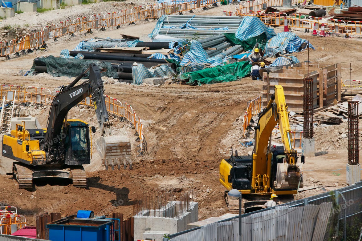 |
Engineering & Construction PhotoSurveyor streamlines project management by providing a precise, location-based visual record of job site progress and asset conditions. Project managers and field engineers can use mapped photos to verify installation milestones, document structural inspections, and maintain a "digital twin" of a construction site over time. By visualizing photos in Google Earth, teams can easily identify the exact location of underground utilities, site equipment, or specific repairs, reducing the need for repeated site visits and improving the accuracy of "as-built" documentation. This geographic organization ensures that high-stakes projects, from pipeline installations to electrical substation builds, remain transparent and well-documented for stakeholders and regulatory compliance. |
| Insurance & Real Estate For professionals in insurance and real estate, PhotoSurveyor acts as a powerful tool for rapid property assessment and transparent reporting. Insurance adjusters can create a comprehensive geographic record of property damage immediately following a storm, allowing for faster claim processing and more accurate damage estimates. In real estate, agents and investors can map high-resolution portfolios of commercial or residential properties, providing clients with an immersive view of the neighborhood context and property features. This spatial organization eliminates the confusion of sorting through hundreds of similar-looking photos, ensuring every image is tied to a specific physical location for undisputed evidence and professional presentation. |
 |
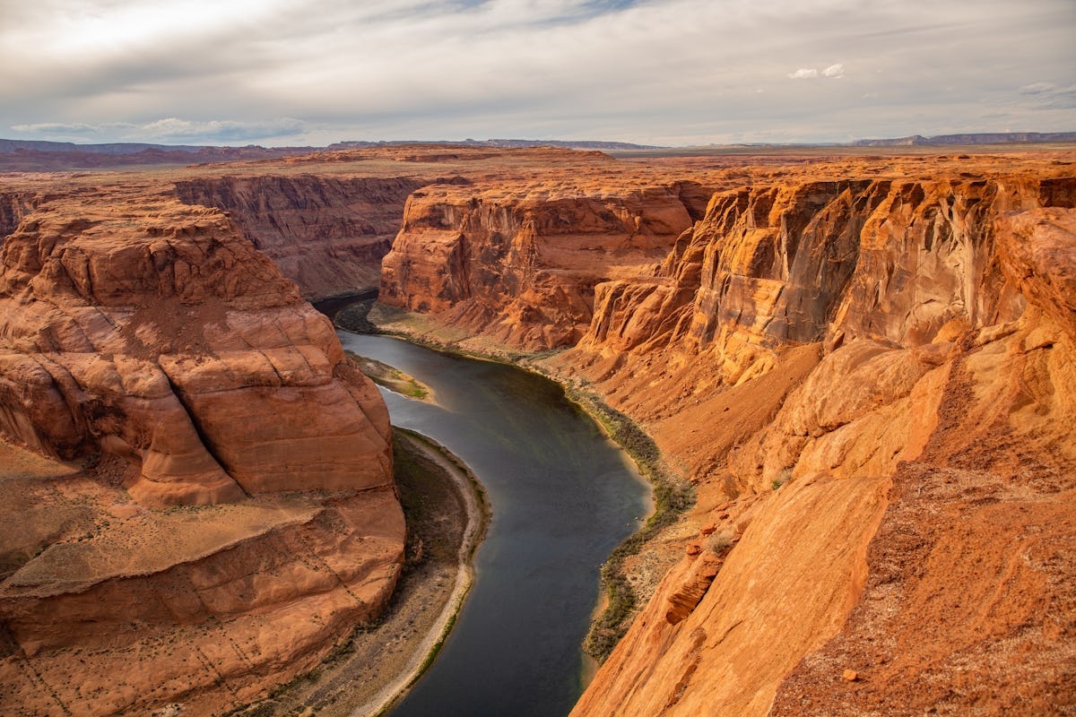 |
Environmental and Wildlife In Environmental and Wildlife Conservation, PhotoSurveyor serves as a critical tool for field researchers and conservationists to create a spatial database of ecological data. By mapping photos of invasive species, nest locations, or signs of habitat degradation, teams can visualize the spread of environmental threats and monitor the effectiveness of restoration efforts over time. This geographic record allows for precise longitudinal studies, where scientists can return to the exact coordinates of a specific plant or geological feature year after year to document changes. Ultimately, transforming field photos into an interactive map facilitates more informed decision-making for land management and provides a compelling visual narrative for stakeholders and grant-funding agencies. |
| Infrastructure and Utility In Infrastructure and Utility Management, PhotoSurveyor provides a robust framework for maintaining sprawling networks of physical assets like power lines, water mains, and telecommunication towers. Maintenance crews can capture high-resolution images of equipment wear, such as corroded insulators or encroaching vegetation, and automatically map them to their exact GPS coordinates. This spatial organization allows asset managers to visualize the health of the entire grid in Google Earth, facilitating the efficient dispatch of repair teams to precise locations rather than relying on vague descriptions. By building a historical geographic record, utility companies can predict failure patterns and streamline long-term infrastructure planning, ensuring regulatory compliance and minimizing service outages through proactive, map-based maintenance. |
 |
 |
Public Safety and Forensics In the field of Public Safety and Forensics, PhotoSurveyor serves as an essential tool for investigators to reconstruct incidents and document complex scenes with geographic precision. By mapping photos of evidence, debris patterns, or structural damage at the site of a fire, accident, or natural disaster, responders can create a spatial "digital twin" of the scene that preserves critical context long after the physical site has been cleared. This interactive map allows investigators to analyze the relationship between different pieces of evidence in a 3D environment, such as Google Earth, providing a clear and indisputable visual narrative for court testimonies or safety audits. Ultimately, this spatial organization enhances the accuracy of forensic reporting and streamlines the collaborative process between law enforcement, insurance investigators, and legal teams. |
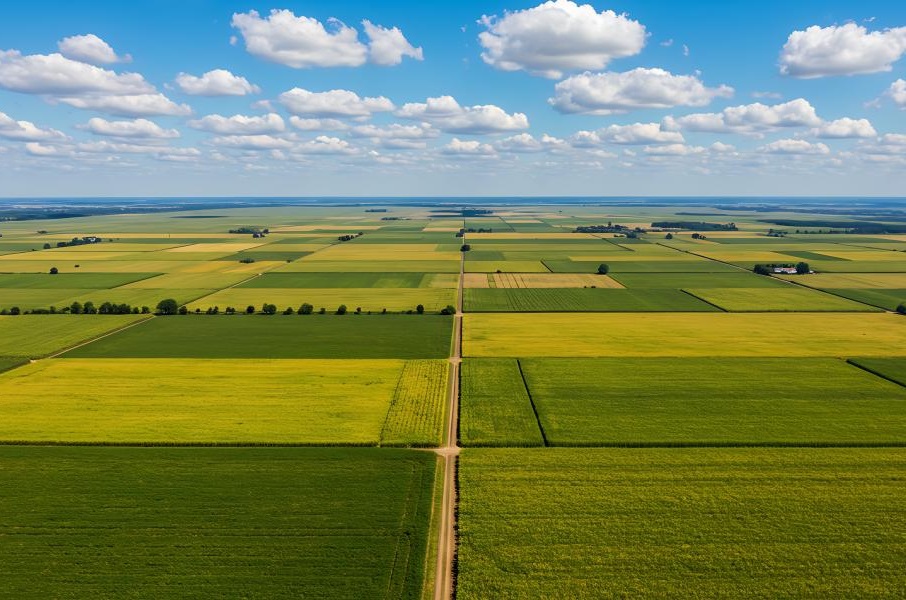
| Agriculture and Land Management In Agriculture and Land Management, PhotoSurveyor enables precision farming by allowing agronomists and land managers to pinpoint localized issues across thousands of acres of crops. By mapping photos of pest infestations, irrigation leaks, or nutrient deficiencies, growers can visualize "problem zones" in Google Earth, ensuring that treatments and resources are applied only where they are truly needed. This geographic tracking is also invaluable for documenting seasonal yields, soil health, and land boundaries, creating a historical spatial record that helps in making data-driven decisions for future planting cycles. Ultimately, this map-based approach reduces waste, optimizes crop health, and provides clear visual documentation for insurance and agricultural subsidies. |
 |
All Rights Reserved © TNDBox 2026